Digitizing Naval Facilities: A Modern Approach to Workspace Management
By Bret Bienkowski, Josh Van Schagen, Alan Flak, P.E., and Bob Brown
By leveraging LiDAR scanning, digital modeling, and integrated planning tools, Naval Sea Systems Command is gaining clearer insight into its physical assets, improving readiness, reducing costs, and setting the stage for smarter space management.

Across the U.S. Navy, efficient facility utilization directly affects mission readiness. Yet for years, many commands have lacked accurate data on how their spaces are configured or aligned with operational needs. Incomplete floor plans, inconsistent terminology, and disconnected tracking systems have made it difficult to identify available workspaces, validate requirements, or plan for realignments.
To address this long-standing gap, Naval Sea Systems Command (NAVSEA) launched a workspace management initiative intended to standardize how space is documented, visualized, and assigned across the agency. This program is replacing legacy records with a digital platform that provides accurate, consistent data that will support facility planning, sustainment, and future infrastructure decisions.
Driven By Technology
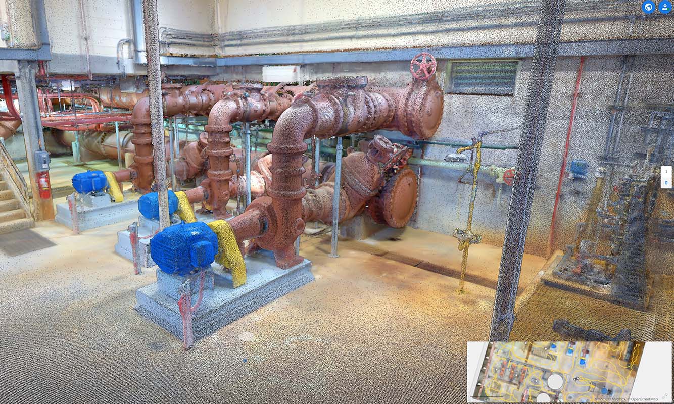
NAVSEA’s evolving workspace management process begins with mobile LiDAR scanning to capture structural and spatial details at centimeter-level precision. These scans are converted into building information models (BIMs), which are then integrated into Archibus, NAVSEA’s enterprise facility management software. The scanning and modeling work is being led by Tetra Tech, and its teams are responsible for LiDAR data capture, BIM development, and integration support to ensure seamless handoff into the Navy’s enterprise systems.
Together, these interrelated tools will be able to provide both planners and leadership with a more comprehensive view of how space is currently used and how it could be used more effectively in the future.
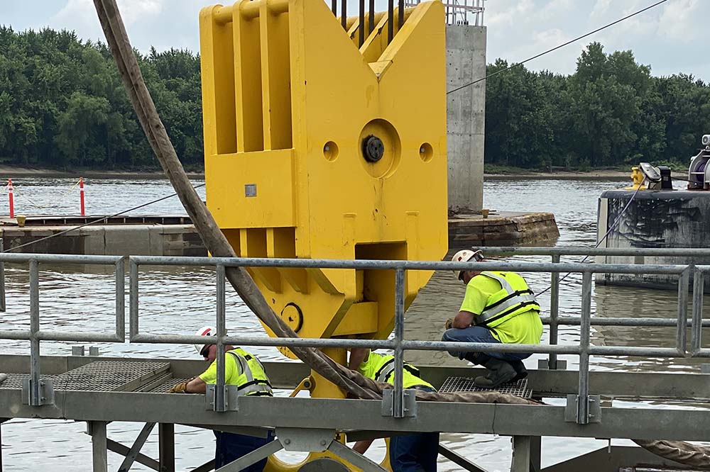
Accelerating Surveys. The ability to increase the volume and decrease the time spent on assessing facility readiness is encouraging. At Puget Sound Naval Shipyard, Wash., more than 5-million-ft² of facilities were scanned and modeled over the course of just four weeks.
Using shoulder-mounted scanners, technicians captured building geometry and layouts with minimal disruption to ongoing operations or access requirements. Under traditional methods, this level of data collection would have required teams to manually measure rooms with tape measures and lasers, document layouts by hand, and convert drawings into digital formats back at the office—a labor-intensive process that could have taken months or even years.
The digital records produced through this program are designed to serve multiple functions, including space planning, asset tracking, infrastructure analysis, and renovation preparation. These capabilities are intended to reduce duplication, improve responsiveness, and better support evolving operational needs.
As the system matures, NAVSEA will be able to visualize space use in real time, identify underutilized areas, and pursue consolidation strategies where appropriate. This progress directly supports broader initiatives within the Department of the Navy, such as reducing the service’s physical footprint, returning to in-person work, and the mission-critical Shipyard Infrastructure Optimization Program (SIOP).
Long-Term Value. Beyond the initial use cases, the workspace management dataset will be a long-term advantage for NAVSEA. As infrastructure needs evolve, planners can extract new insights from the original LiDAR scans, such as the location of mechanical systems or life safety equipment, without needing to revisit sites. Think of the advances in smart systems in the last two decades, and how they now are interlocked with fixed structures.
Installations are continually enhancing their infrastructure systems and physical networks. Having the ability to “mine the model” offers potential cost and time savings, especially for future renovation or MILCON planning, where accurate building data helps reduce rework and unknowns.
Framework For Alignment
Importantly, modernizing workspace management is expected to improve consistency across NAVSEA’s field activities. Through a centralized platform and a shared data dictionary, the program will align how different sites define, track, and report on workspace types and conditions. This unified structure will support more accurate data calls, streamlined maintenance workflows, and allow for quicker decisions on space assignments and personnel moves. Users will be able to log facility issues directly within the tool, allowing for clearer issue tracking and long-term maintenance planning. The system also enables on-the-ground users to access up-to-date space data to support daily operations and make informed decisions at the installation level.
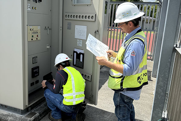
Security Assurances. An early challenge for NAVSEA has been the security review of imagery. LiDAR scans generate thousands of panoramic images for each facility, far more than a traditional survey crew might produce. To ensure that no sensitive information is captured, security teams must review each image before it is cleared for use. While the resolution is typically not high enough to expose sensitive data, the process still requires rigorous validation.
Over the longer term, the expectation is that as the process becomes the standard, NAVSEA will explore more ways to streamline reviews while maintaining information security.
Deriving Cost Savings. NAVSEA’s workspace management initiative is more than a systems upgrade. It is an operational strategy to improve decision-making, asset accountability, and mission agility. By integrating advanced scanning, modeling, and planning tools under a single system, the Navy is steering toward a new standard for infrastructure readiness.
While the initiative is still ongoing, early assessments suggest significant value. A 2017 business case analysis projected potential savings of more than $25 million across the NAVSEA enterprise through improved space utilization, fewer relocations, and faster planning cycles. As more sites are added to the system, the command expects to reduce the need for redundant surveys and build on a common operational picture.
Mission-Aligned Approach
For other federal agencies facing similar challenges, NAVSEA’s workspace management model offers a replicable framework. Its implementation illustrates how a coordinated, technology-enabled approach can lead to more efficient, mission-aligned facility management. Because as outdated systems are phased out and infrastructure requirements only grow, reliable space data and consistent planning tools become indispensable.
In an environment of constrained budgets despite ever-expanding requirements, that ability to understand exactly what space is available and how to make the best use of it is critical. Embracing innovation and encouraging collaboration will help government manage facilities more effectively today, and plan with confidence for the demands of tomorrow.

Bret Bienkowski is Mobile Mapping Survey Manager, Josh Van Schagen is Prior Workspace Management Program Manager, Alan Flak, P.E., is BIM and Modeling Lead, and Bob Brown is WSM Contract Program Manager, Tetra Tech. They can be reached
at bret.bienkowski@tetratech.com; josh.vanschagen@tetratech.com; alan.flak@tetratech.com; and rbrown@bwfed.com.
A Digital Foundation
The framework for NAVSEAS’s efforts today began more than a decade ago. Initial evaluations compared commercial software platforms for their ability to support Navy-specific facility management workflows. Following a couple of successful pilots, Archibus was selected and eventually scaled up to support wider implementation. LiDAR and BIM modeling later were incorporated to address persistent gaps in floor plan accuracy and asset data, establishing a digital-first approach that continues to shape the program.
Beyond cost savings, the new workspace management system is positioned to help NAVSEA respond to changing mission needs with greater agility, enhancing readiness and security. With enterprise-wide space visibility and data-driven tools at their disposal, leadership can make faster, more informed infrastructure decisions as operational demands evolve.
Published in the September-October 2025 issue of The Military Engineer
Check Out Related Articles From TME
-

Innovative PFAS Remediation at Camp Grayling
For project stakeholders and remediation managers confronted with PFAS, Regenesis demonstrates the efficacy of using Regenesis’ PlumeStop® colloidal activated carbon (CAC) at Camp Grayling, Michigan. -
A Standardized Approach to Aircraft Fire Training Infrastructure
To support enterprise-wide airmen readiness, the U.S. Air Force is modernizing its standard design for aircraft fire training facilities—introducing digital controls, dual-fuel systems, and PFAS-conscious infrastructure. -
Delivering Energetic Materials Manufacturing Facilities
Designing and constructing facilities that manufacture, process, handle, or store explosives and energetic materials present some of the most challenging defense projects—requiring technical experience, strict safety protocols, and a comprehensive understanding of regulatory frameworks. -
Forging Tradition and Innovation: A New Design Standard at Camp Lejeune
The II MEF Headquarters at Camp Lejeune blends Georgian Revival architecture with modern sustainability—delivering durability, efficiency, and precision that meets contemporary functional requirements while honoring heritage. -

Balancing Efficiency and Fiscal Responsibility
The continuing contracts clause offers the U.S. Army Corps of Engineers a way to improve project delivery and enhance fiscal responsibility by aligning funding with project execution. -
Next Steps for Digital Twin Development
U.S. Forces Japan is laying the groundwork for future integration of digital twin technology in order to validate and collect data that will offer comprehensive insights into utility conditions at installations and enhance overall decision-making, efficiency, and resilience.