Enhancing Wildfire Recovery Through AI-Powered Detection
By Prashant Jadiya and Olivia Su, M.SAME
To aid in recovery efforts after the 2023 Maui wildfire, an AI-driven computer vision program was developed to identify burnt vehicles in Lahaina and expedite debris removal.
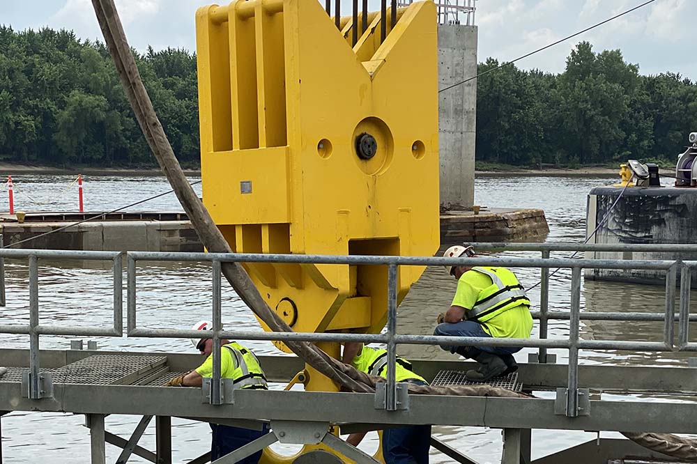
In August 2023, a wildfire on the island of Maui in Hawaii changed the lives and the landscape of Lahaina forever. A catastrophic mix of high winds, extremely dry air, and drought caused wildfires to erupt. The resulting widespread devastation included the loss of thousands of homes, businesses, and cultural centers. In the wake of the destruction, an extensive response effort, contracted and coordinated through the U.S. Army Corps of Engineers and Federal Emergency Management Agency, handled critical debris removal and the safe identification, disposal, and recycling of thousands of vehicles burnt during the wildfire.
The accurate identification of burnt vehicles is crucial for efficient and safe post-fire operations such as debris removal. Burnt vehicles pose potential hazards and risks to people, wildlife, and the environment following a wildfire. Potential hazards found within and surrounding burnt vehicles must be mitigated as quickly as possible to minimize potential risks to the public, the debris removal teams, and the environment.
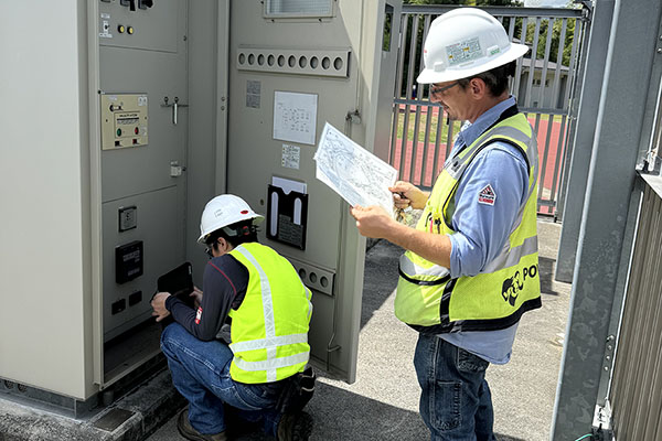
To accomplish the large-scale debris removal, the contracted team in Lahaina, led by ECC Constructors LLC, leveraged technology and data management expertise to utilize the most advanced technologies for the safety and health of response teams and the local community. This included computer vision algorithms and artificial intelligence (AI).
The specific algorithm model employed in Hawaii aimed to identify and tally burnt vehicles so the emergency response contractor could properly plan for the effort and allocate the appropriate resources needed. Understanding the scope was crucial in order to safely dispose of burnt vehicles and the potentially hazardous materials released into the environment.
Building A New Model
Implementing AI for a complex purpose like identifying wildfire damage is not without challenges. The need for high-quality data sets and constant model training is an obstacle. The diverse range of vehicles and fire conditions in the Maui wildfires also required a robust AI system capable of handling various scenarios. Privacy concerns regarding the use of surveillance imagery and the potential for false positives or negatives posed operational challenges.
Due to the urgent nature of the wildfire response efforts, low-altitude aerial survey images for the specific impact area were not available. The data team investigated numerous options for high-resolution satellite images instead.
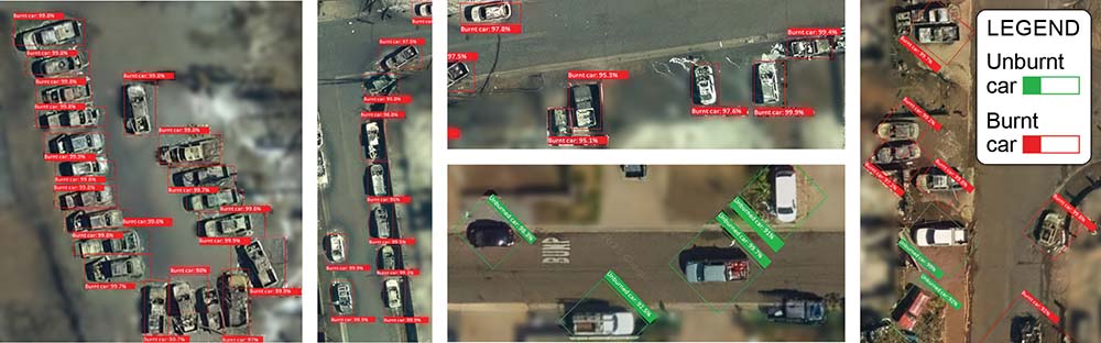
After careful evaluation of the quality and recency of the data, ECC decided to use publicly available high-resolution satellite imagery data captured right after the wildfire on Aug. 13, 2023. Crews mapped out the entire Lahaina area, covering more than 1,350-acres of land and focusing on the affected structures. Various techniques were tested and utilized to identify, crop, and resize satellite images for optimal outcomes in the computer vision model. As a result of rigorous testing, it was decided to use 19x zoom images with a 7-cm resolution. More than 4,100 images were incorporated into the model.
Training And Evaluation
To train the AI, the team used a deep learning-based computer vision model for object detection. Approximately 150 images were labeled with both burnt and unburnt vehicles for training purposes. Detailed configurations and thresholds of the model then were calibrated to minimize false positives and improve overall accuracy.
The model evaluation process was iterative and focused on the prediction accuracy for specific areas of objects within the images. Initially, the model’s performance was assessed by evaluating its ability to detect burnt vehicles in the labeled dataset and a few images that were not part of the training set. The precision, recall, and mean average precision metrics were used to gauge the model’s effectiveness.
In the first iteration, a single model was used to detect burnt cars. It achieved 68 percent precision and 73.3 percent recall. After inspecting the predictions, data scientists observed that some unburnt cars were mistakenly classified as burnt cars, which impacted the model’s precision and recall. To address this issue and improve performance, the team introduced a new label for unburnt cars, separating the two categories. Additionally, the training dataset size was increased to three times the original number of images, providing the model with more diverse examples. After another iteration, this adjustment resulted in a precision of 90.9 percent and a recall of 81.1 percent at a 95 percent confidence threshold. The threshold value was determined by manually reviewing a sample of images along with their prediction confidences. This allowed the team to define an optimal ceiling within the threshold range.
During each iteration, the model’s predictions were carefully analyzed to identify areas where the AI struggled, such as misclassifying unburnt vehicles as burnt or failing to detect burnt vehicles altogether. Based on these evaluations, additional features were added in order to enhance detection capabilities. This included incorporating more diverse training images, adjusting the image pre-processing techniques, and fine-tuning the model’s hyperparameters.
Crews mapped out the entire Lahaina area, covering more than 1,350-acres of land and focusing on the affected structures. Various techniques were tested and utilized to identify, crop, and resize satellite images for optimal outcomes in the computer vision model.
Achieving High Accuracy
The evaluation process involved four iterations of training, fine-tuning, and evaluation. This ensured the model was robust and capable of accurately detecting burnt vehicles in newer images, to effectively support the Maui wildfire debris removal project. By the final iteration, the model achieved an average precision of 88.65 percent at a 0.95 confidence threshold. The team derived a count of 2,477 burnt vehicles by averaging the predicted positive count of the two models. Also, a higher prediction count of 2,993 was derived from the two lower threshold models, to be conservative and allocate sufficient resources for the mission.
After carefully examining the output, the team determined the total burnt vehicle count in the Lahaina area totaled between 2,477 and 2,993. This figure does not include motorcycles, all-terrain vehicles, golf carts, and marine vessels. It was noted that from the aerial images, some vehicles may be covered by shadows, burned structure debris, or other structures like carports.
To validate the computer vision output, a field survey team was deployed to perform reconnaissance. The survey result indicated there were around 2,500 burnt vehicles, including buses, cars, and trucks, as of Oct. 21, 2023, confirming the computer model prediction. After the project was completed, the actual number of burnt vehicles removed was 2,467, which achieved 99.6 percent accuracy with a 0.95 threshold based on the model’s prediction of 2,477 burnt vehicles.
Overall, while the model training process used in Hawaii took approximately 8.5 hours, the length of time to complete a similar process on future missions is highly dependent on the quality and availability of the data, as well as the model’s performance.

Expediting Response Efforts
The increasing frequency and intensity of wildfires, especially across California, Hawaii, and the Pacific Northwest, have presented significant challenges for first responders and disaster management agencies.
Using computer vision algorithms to identify burnt vehicles offers a safe alternative (or complementary method) to traditional on-ground surveys, which can be time-consuming, costly, and potentially dangerous. Field-validated in Hawaii, this innovative, cost-effective approach encourages faster, safer resource planning; expedites site clean-up, benefiting citizens and businesses; prioritizes first responder safety; and sets a new standard for more efficient post-disaster operations and emergency management.
Accurate Approach
The AI-integrated burnt vehicle computer program used in Maui following the 2023 wildfires showed remarkable accuracy in identifying targeted objects using satellite imagery.
The program not only expedited the survey and estimate process but also enhanced the safety of first responders by providing them with valuable resource-saving information on the location and condition of vehicles. Burnt vehicles pose potential hazards and risks to people, wildlife, and the environment; these can be magnified by the type of car, location and surrounding landscape, and the severity of destruction.
Prashant Jadiya is Data Scientist, and Olivia Su, M.SAME, is Data Science Consultant, ECC. They can be reached at pjadiya@ecc.net; and olivia.su.mengzhen@gmail.com.
Published in the September-October 2025 issue of The Military Engineer

Check Out Related Articles From TME
-

Innovative PFAS Remediation at Camp Grayling
For project stakeholders and remediation managers confronted with PFAS, Regenesis demonstrates the efficacy of using Regenesis’ PlumeStop® colloidal activated carbon (CAC) at Camp Grayling, Michigan. -
A Standardized Approach to Aircraft Fire Training Infrastructure
To support enterprise-wide airmen readiness, the U.S. Air Force is modernizing its standard design for aircraft fire training facilities—introducing digital controls, dual-fuel systems, and PFAS-conscious infrastructure. -
Delivering Energetic Materials Manufacturing Facilities
Designing and constructing facilities that manufacture, process, handle, or store explosives and energetic materials present some of the most challenging defense projects—requiring technical experience, strict safety protocols, and a comprehensive understanding of regulatory frameworks. -
Forging Tradition and Innovation: A New Design Standard at Camp Lejeune
The II MEF Headquarters at Camp Lejeune blends Georgian Revival architecture with modern sustainability—delivering durability, efficiency, and precision that meets contemporary functional requirements while honoring heritage. -

Balancing Efficiency and Fiscal Responsibility
The continuing contracts clause offers the U.S. Army Corps of Engineers a way to improve project delivery and enhance fiscal responsibility by aligning funding with project execution. -
Next Steps for Digital Twin Development
U.S. Forces Japan is laying the groundwork for future integration of digital twin technology in order to validate and collect data that will offer comprehensive insights into utility conditions at installations and enhance overall decision-making, efficiency, and resilience.