Next Steps for Digital Twin Development
By Ryan McMurtrey, P.E., PMP, M.SAME
U.S. Forces Japan is laying the groundwork for future integration of digital twin technology in order to validate and collect data that will offer comprehensive insights into utility conditions at installations and enhance overall decision-making, efficiency, and resilience.
As dynamic replicas of physical assets, systems, and processes, digital twins represent a pivotal advancement in modern engineering. By leveraging real-time data and advanced analytics, these virtual environments enable engineers to visualize, monitor, and optimize system performance. They provide comprehensive insights into utility conditions and facilitate more informed decision-making, greater operational efficiency, and enhanced resilience against potential disruptions.
Creating a digital twin is no simple task. With the right information and tools, however, it is possible to take the first steps toward achieving operational efficiency through nodal analysis and digital twin integration.
In 2023, realizing that aging infrastructure and fragmented information systems posed a significant risk for the operational efficiency of a base in its jurisdiction, U.S. Forces Japan chose to embrace the potential of investing in a digital twin solution. The organization enlisted POWER Engineers, member of WSP, to conduct a comprehensive utility system assessment for 30 electrical stations over a three-week period.
Addressing Readiness
A combination of incomplete, inconsistent data collection and communication silos had previously made it difficult for U.S. Forces Japan to manage complex utility systems. The lack of visibility into how different components worked together meant that decision-makers and system operators were unable to accurately assess vulnerabilities or predict the implications of potential failures. If a single part of the system were to go down, it was unclear how it would impact other interconnected parts. This would lead to potential consequences ranging from mild inconveniences to mission critical disruptions. Moreover, the inability to track and understand the condition of equipment made it challenging to determine when maintenance or updates were necessary. Without reliable data, decisions were based on assumptions rather than accurate information, further compromising the safety and reliability of the infrastructure.
Recognizing these critical gaps, U.S. Forces Japan initiated a project that aimed to validate, collect, and organize data on their utility assets. The goal was to facilitate the sustainable maintenance of high-reliability infrastructure capable of off-grid operation during emergencies while improving the overall safety and efficiency for people working with the equipment.
Validation And Collection
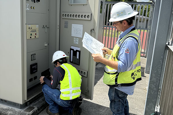
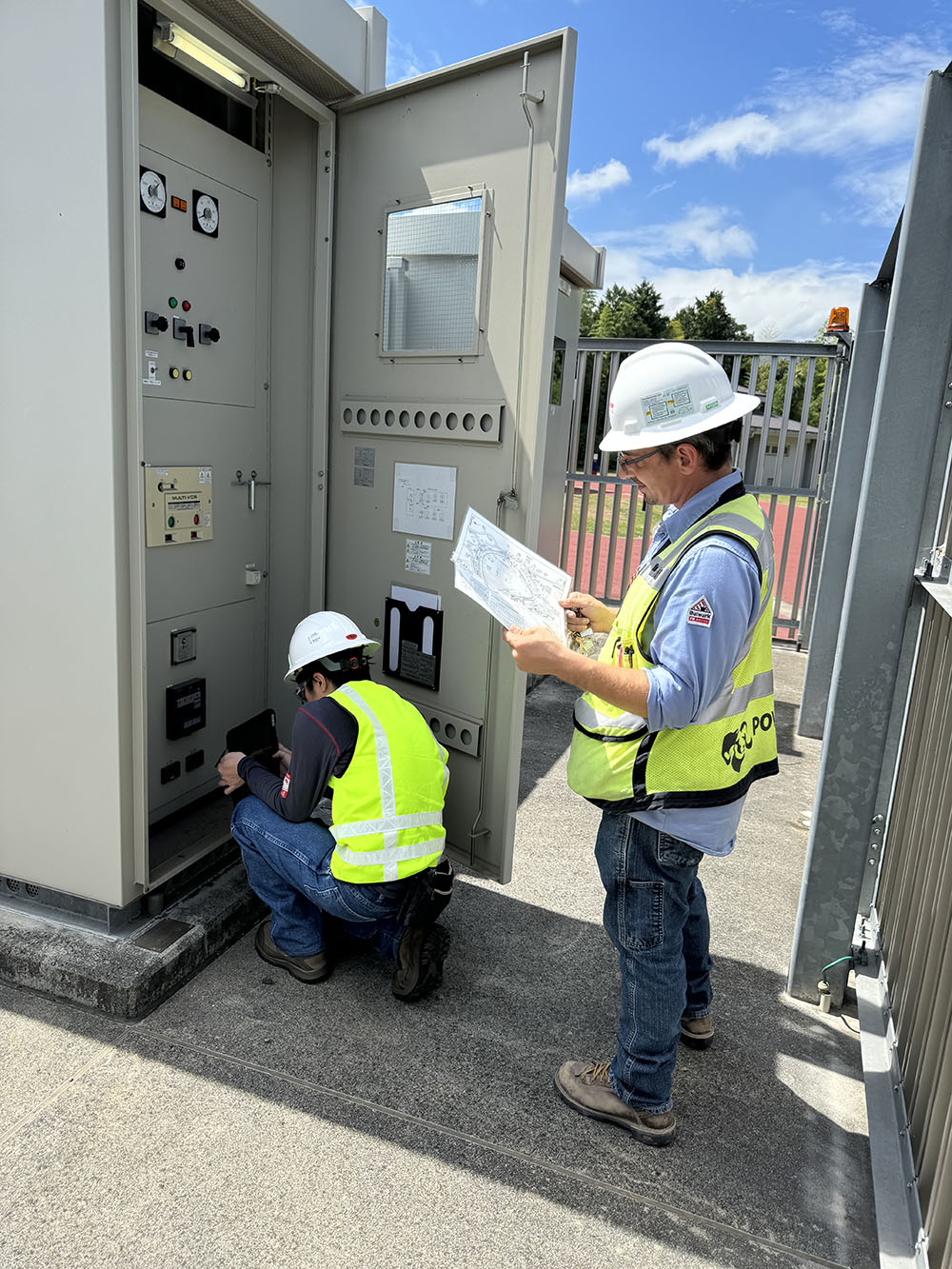
The process began with validating the data owned by the government within the existing geographic information system (GIS). Teams took to the field and used wireless devices, including tablets and smartphones, to collect detailed data on critical assets. This included information like size, age, condition, location, photos, hard key entries, and other specifications for each piece of equipment. Data was either confirmed or updated. Any gaps were filled. This structured approach ensured that every piece of equipment was documented consistently.
Additionally, an unexpected opportunity arose during the data collection phase that provided significant benefits.
The data collection team, which consisted of Japan-based engineers and U.S.-based quality assurance specialists, took advantage of the time zone differences between Japan and the reach-back support stateside to expedite the data collection process. The end of the workday in Japan corresponded to around 3:00 a.m. in Boise, Idaho, where the quality assurance specialists were located; and the end of the workday in Boise corresponded to around 8:00 a.m. in Japan. This meant that field engineers could send the data they collected back to the United States for evaluation at the end of their day and, by the time they woke up the next morning, the quality assurance group had meticulously combed through the materials, identifying any discrepancies or areas requiring further clarification.
The rapid feedback loop was essential for high-integrity data collection without significant delays. Unlike traditional methods where discrepancies might only be discovered after leaving the site (requiring return trips, reliance on conservative assumptions, or a burden on the client to collect more data), this novel approach allowed for efficient corrections and continuous improvement while boots were still on the ground.
The survey results were nothing short of remarkable: more than 150 electrical stations were assessed within three weeks—five times the expected workload.
Embracing A New Model
The ArcGIS model previously used by U.S. Forces Japan featured georeferenced data overlaid on a map of the base. This offered a static visual representation of the infrastructure. Often, insufficient detail and inaccurate or incomplete data meant that drawing meaningful conclusions about the state of systems was difficult. For a deeper look into the electrical infrastructure, the project team developed a new electrical system model using PowerTools SKM.
Developing this model started with drawing on a detailed database that included all relevant information about transformers, switchgear, cables, and other critical components. By leveraging advanced GIS tools and structured data collection methods, engineers ensured that the model accurately represented the current state of the base’s electrical systems.
It is important to note that the electrical system model produced is not georeferenced or to scale like GIS. The ArcGIS tool provides more of an “as-built” system model, with each device represented in a location-accurate map and attributes available for every device. However, this interface lacks the connectivity that allows a user to see the interactive element of the system.
The SKM tools allow users to virtually test electrical load scenarios to better understand how the system will react and which parts would be most affected by some sort of load change or device failure. This functionality drives a better understanding and analysis of connectivity issues, dependencies, and potential vulnerabilities.

Cohesive Integration
The comprehensive data validation, collection, and organization techniques conducted for U.S. Forces Japan represent critical first steps toward achieving full digital twin integration. While the project successfully laid the groundwork, there are several key steps ahead that could lead to a fully integrated digital twin solution.
At present, the validated GIS data, SKM electrical system models, and other essential datasets remain siloed within separate systems that do not yet communicate effectively with each other—limiting the ability to leverage their combined potential. To move forward, the next phase should involve breaking down these silos and establishing seamless communication between datasets. This requires technology investment that can bridge gaps between disparate systems and facilitate real-time data exchange.
Future efforts also should be encouraged to focus on creating a cohesive digital environment where all relevant information is accessible from a single platform. Leveraging tools powered by machine learning could enhance predictive capabilities—enabling proactive maintenance strategies while still optimizing resource allocation during routine operations and emergencies.
Timing The Advantage
The path to a cohesive digital twin may seem distant for facilities with limited budgets, but each step of the process provides value. These systems can be built up over time and managed as distinct projects with separate budgets.
The timeline is patient as well. Agencies only need to take the next step when they are ready. For those with varying infrastructure readiness priorities and fluctuations in funding availability, that flexibility is a valuable advantage to ensure they do it right.
Ryan McMurtrey, P.E., PMP, M.SAME, is Senior Program Manager, POWER Engineers, member of WSP; ryan.mcmurtrey@wsp.com.
Published in the September-October 2025 issue of The Military Engineer

Check Out Related Articles From TME
-

Innovative PFAS Remediation at Camp Grayling
For project stakeholders and remediation managers confronted with PFAS, Regenesis demonstrates the efficacy of using Regenesis’ PlumeStop® colloidal activated carbon (CAC) at Camp Grayling, Michigan. -
A Standardized Approach to Aircraft Fire Training Infrastructure
To support enterprise-wide airmen readiness, the U.S. Air Force is modernizing its standard design for aircraft fire training facilities—introducing digital controls, dual-fuel systems, and PFAS-conscious infrastructure. -
Delivering Energetic Materials Manufacturing Facilities
Designing and constructing facilities that manufacture, process, handle, or store explosives and energetic materials present some of the most challenging defense projects—requiring technical experience, strict safety protocols, and a comprehensive understanding of regulatory frameworks. -
Forging Tradition and Innovation: A New Design Standard at Camp Lejeune
The II MEF Headquarters at Camp Lejeune blends Georgian Revival architecture with modern sustainability—delivering durability, efficiency, and precision that meets contemporary functional requirements while honoring heritage. -

Balancing Efficiency and Fiscal Responsibility
The continuing contracts clause offers the U.S. Army Corps of Engineers a way to improve project delivery and enhance fiscal responsibility by aligning funding with project execution. -
Next Steps for Digital Twin Development
U.S. Forces Japan is laying the groundwork for future integration of digital twin technology in order to validate and collect data that will offer comprehensive insights into utility conditions at installations and enhance overall decision-making, efficiency, and resilience.