Engineering a Decisive Advantage Through Geospatial Technologies
By Lt. Col. David Foster, M.SAME, USA (Ret.), Col. Kevin Golinghorst, P.E., M.SAME, USA (Ret.), and Craig Hancock, GISP, M.SAME
As geospatial capabilities evolve and usability grows, military engineers are achieving a decisive advantage by integrating these technologies into a unified system that supports more informed and effective decision-making.
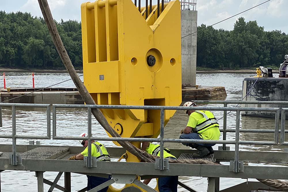
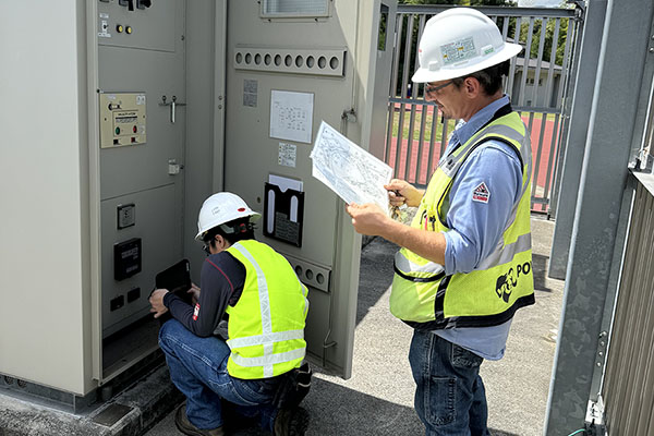
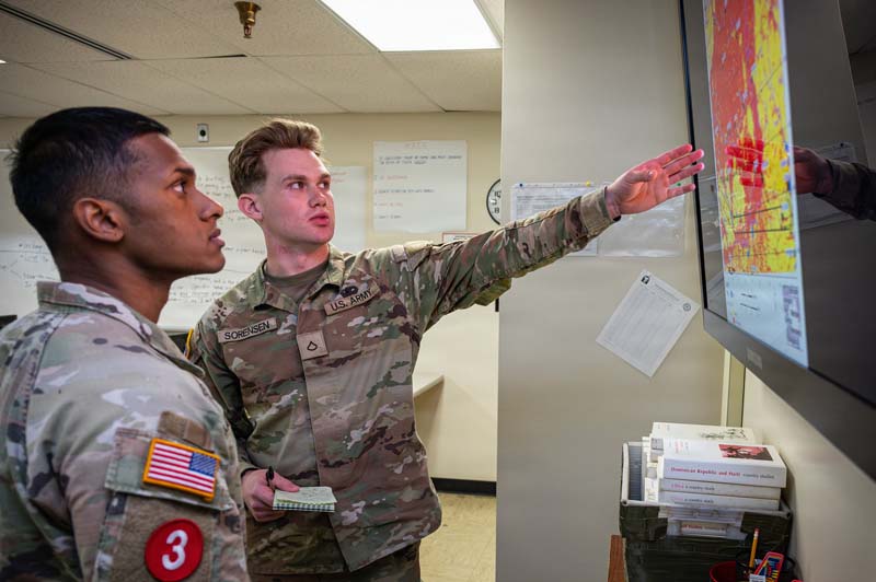
The successful adoption of innovative geospatial capabilities requires greater system integration, standardization of data, and organizational commitments to ensure that information can be shared and effectively applied across enterprises. Photo by Melissa Buckley, Fort Leonard Wood Public Affairs.
For millennia, location information has provided engineers with the clarity and context needed to fully understand and shape the terrain. In the modern day, the ability to do this has advanced with the introduction of digital technologies, from early computing tools to intelligent systems that continue to rapidly evolve and mature, then iterate quickly again.
Keeping pace with technological advancements is not new. In 1991, the U.S. Air Force’s inaugural Civil Engineering Doctrine document, AFM 3-2, Civil Engineering Combat Support Doctrine, touched on the collective belief that civil engineering equipment and systems would become more technical as each year passed. Since 2000, the rate of development has rapidly expanded with little to no time between evolutions, which impacts the ability of agencies to be able to seamlessly adopt new technologies as they emerge.
Over time, personal computers, the internet, enterprise information systems, and cellular phones have become ubiquitous tools within every toolbox. The organizational adoption, too, of geographic information systems (GIS), building information models (BIM), computer aided design (CAD), high-definition survey equipment, mobile data collection devices, light detecting and ranging (LiDAR), and airborne and terrestrial remote sensing platforms has become the norm within industry.
Throughout history, militaries that understood the terrain first gained the advantage. Being first now demands responsive, focused, and sustained geospatial technology integration—exchanging the pursuit of single “silver bullet” solutions for those able to optimize and be optimized by others.
Future military engineering success, however, will require a culture centered on a holistic system-of-systems approach that fosters adoption and integration of the next innovations, while still maintaining strict adherence to geospatial data standards and technical procedures.
Integration Keys
Rising demand for high-fidelity location data runs parallel to geospatially enabled technological advancements. The successes marked by innovators and early adopters, however, are not due solely to the employment of these tools; it is the integration of the tools and harnessing the data they generate that enables the greatest return on investment.
Leveraging the collective power of available geospatial technologies is an operational and financial imperative for those who seek to improve data quantity, quality, and interoperability for enhancing data-driven decisions, optimizing execution, reducing risks, and increasing cost savings.
It has been estimated that the cost of construction re-work due to insufficient or inaccurate data is 14 percent above the initial pricetag of a project. Applied to the 2025 federal military construction budget, this would equate to $2.6 billion. To maintain the decision advantage, engineers cannot afford bad data.
Effectively investing in technology gains takes a commitment of time and energy by executive leadership and cross-functional subject matter experts to facilitate cultural adoption. Establishing a strong vision, strategy, standards, procedures, and their unconditional enforcement is a must. Without, the result is an expansion of silos at greatly increased costs.
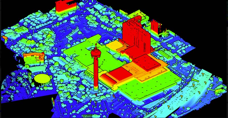
Increasingly, geospatial technologies are providing military engineers with the high-fidelity location data needed to improve decision-making, optimize project execution, reduce mission risk, and enhance operational effectiveness. Photo by Dave Foster.
Analyzing Impacts
In the recent analysis of geospatial progression, the technology, on a broad level, has been used to optimize investments and increase mission effectiveness on every job site or mission space where engineers tread.
Installation Management. In 2001, the Air Force’s GeoBase Program was established, with a charge best summarized by the motto, “One Base, One Map.” Within a short few years, Installation Geospatial Information & Services enterprise programs were established within the Office of the Secretary of Defense, U.S. Army, U.S. Navy, and U.S. Marine Corps, followed by the Washington Headquarters Service and U.S. Army Corps of Engineers (USACE).
A central component of these many programs is the Spatial Data Standard for Facilities, Infrastructure, and Environment (SDSFIE)—a robust framework that ensures consistent, high quality geospatial data for built and natural infrastructure across the Department of Defense (see sidebar). Compliance with these standards, as outlined in DODI 8130.01 Installation Geospatial Information & Services, strengthens data quality and interoperability for products derived from modern geospatial platforms and artificial intelligence. This, in turn, enables seamless integration and analysis at both the local and enterprise levels.
Air Force Academy Chapel Restoration. The renovation of the Cadet Chapel at the Air Force Academy in Colorado has been made possible by decisions informed by geospatial-enabled technologies. As early as 2013, project activities included the employment of BIM, CAD, GIS, LiDAR, high-definition survey equipment, and small unmanned aerial systems, which were used to assess structural challenges to inform plans and execution of a complex $335 million renovation. The integration of high-fidelity location data has continued to inform work on the iconic building, scheduled to be completed in 2028.
Francis Scott Key Bridge Recovery. The multi-agency response to the 2024 collapse of the Francis Scott Key Bridge in Baltimore was enabled through the establishment of a Unified Command. A number of crucial decisions related to the dignified recovery of remains, dredging and clearance operations, and the highly technical removal of the ship and collapsed bridge structures were greatly informed by geospatial-enabled technologies employed by the U.S. Coast Guard, National Oceanic & Atmospheric Administration, USACE Baltimore District, Army Geospatial Center, and data from the Maryland Transportation Authority and City of Baltimore.
Specifically, critical decisions were bolstered by the integration, analysis, and visualization of data generated from bathymetric sensors, GIS, high-resolution 3D aerial imagery sensors, LiDAR systems, multi-beam sonar, and structure from motion photogrammetry systems. Collectively, these tools facilitated the shared situational awareness required to meet the operational demands of each partner organization.
Expect the adoption of geospatial-enabled technologies to evolve at a rapid pace, as will the convergence of data they generate. Within the next decade, employment of mobile devices, remote sensing platforms, high-definition survey equipment, and infrastructure sensors will become the norm rather than the exception.
Evolving Systems
Expanded employment of AI-driven “smart-systems” partnered with geospatial technologies promises to further expand the decision advantage.
Expect the adoption of geospatial-enabled technologies to evolve at a rapid pace, as will the convergence of data they generate. Within the next decade, employment of mobile devices, remote sensing platforms, high-definition survey equipment, and infrastructure sensors will become the norm rather than the exception. Organizations will pursue seamless two-way sharing of data between critical information systems to enable predictive analytics and automation. Their recognition and treatment of data as a strategic resource and implementation of advanced modeling processes will empower a plethora of tasks rather than singular decisions or actions.
Concurrently, early adopters will build dynamic and adaptive geospatial environments that provide real-time insight through employment smart facility technologies, autonomous vehicle data collection, advanced modeling, AI-driven feature extraction and analysis, augmented reality, and the employment of cloud-based technologies. The expectation is that this integration will free human operators to focus on other priorities necessary to deliver and sustain the decision advantage.
The next innovators will blaze trails in developing and employing emergent geospatial enabled technologies to inform terrestrial engineering missions, and, given the right conditions, will do the same in support of lunar base plans, construction, and sustainment away from earth.
Advancement Unlocked
Effective adoption of advanced geospatial technologies is no longer a discretionary advantage: it is a foundational requirement for modern engineering and mission execution. Meaningful returns are realized only when these capabilities operate as an integrated system of systems, not in isolation. This enterprise integrated approach is the most effective way to unlock true decision advantage, operational efficiency, and long term value.
Success will require a holistic approach grounded in a culture of collaboration that synchronizes geospatial data standards and their enforcement, advanced analytical tools, mission-focused applications, and modernized operational processes. This nexus transforms disparate data into comprehensive information for leaders and action takers.
A commitment to this integrated model is essential for engineers to achieve and maintain the advantage on which to build and secure the nation’s future—whether downrange or in delivering facilities and infrastructure crucial to defend tomorrow.
Agency Standard-Bearers
The advent of core engineering software has roots to the middle of the 20th century, with usage gaining interest during the 1980s and 1990s. For example, employment of GIS to bolster the mission of warfighters dates back several decades, with geospatial engineering digital capabilities mainly attributable to the efforts of the Engineering Topographic Laboratory, established in 1963, and several agencies later spawned, including the National Geospatial-Intelligence Agency, Army Geospatial Center, and Geospatial Research Laboratory.
In 1987, USACE’s Waterways Experimentation Station established its CADD Center. In 1990, GIS was added to the mission, and in 1992 it evolved into the Tri-Service CADD/GIS Center, located in Vicksburg, Miss. Over the next decade, the Coast Guard, Defense Logistics Agency, U.S. Marine Corps, National Aeronautics & Space Administration, General Services Administration, Environmental Protection Agency, and Department of State joined the group.
Renamed the CAD-BIM Center, the enterprise remains responsible for CAD and BIM standards, promoting system integration, and exploring new technologies for facilities, infrastructure, and environment within the Defense Department. While infrastructure GIS remains important to the CAD-BIM Center, responsibility for SDSFIE shifted in 2002 with establishment of the Defense Installations Spatial Data Infrastructure (DISDI).
Today, DISDI’s mission continues through the Office of Infrastructure Modernization & Resilience within the Assistant Secretary of War (Energy, Installations & Environment), to include department responsibility for the geospatial policy and standards that provide a data framework for installations and warfighter support infrastructure.
Lt. Col. David Foster, M.SAME, USA (Ret.) is Founder, 372 Consulting LLC; david.foster@372consulting.com.

Col. Kevin Golinghorst, P.E., M.SAME, USA (Ret.), is Director of Business Development - Federal Design, Benham Design LLC; kevin.golinghorst@benham.com.

Craig Hancock, GISP, M.SAME, is Physical Scientist, U.S. Army Geospatial Center; craig.a.hancock@usace.army.mil.
Published in the September-October 2026 issue of The Military Engineer

Check Out Related Articles From TME
-

Innovative PFAS Remediation at Camp Grayling
For project stakeholders and remediation managers confronted with PFAS, Regenesis demonstrates the efficacy of using Regenesis’ PlumeStop® colloidal activated carbon (CAC) at Camp Grayling, Michigan. -
A Standardized Approach to Aircraft Fire Training Infrastructure
To support enterprise-wide airmen readiness, the U.S. Air Force is modernizing its standard design for aircraft fire training facilities—introducing digital controls, dual-fuel systems, and PFAS-conscious infrastructure. -
Delivering Energetic Materials Manufacturing Facilities
Designing and constructing facilities that manufacture, process, handle, or store explosives and energetic materials present some of the most challenging defense projects—requiring technical experience, strict safety protocols, and a comprehensive understanding of regulatory frameworks. -
Forging Tradition and Innovation: A New Design Standard at Camp Lejeune
The II MEF Headquarters at Camp Lejeune blends Georgian Revival architecture with modern sustainability—delivering durability, efficiency, and precision that meets contemporary functional requirements while honoring heritage. -

Balancing Efficiency and Fiscal Responsibility
The continuing contracts clause offers the U.S. Army Corps of Engineers a way to improve project delivery and enhance fiscal responsibility by aligning funding with project execution. -
Next Steps for Digital Twin Development
U.S. Forces Japan is laying the groundwork for future integration of digital twin technology in order to validate and collect data that will offer comprehensive insights into utility conditions at installations and enhance overall decision-making, efficiency, and resilience.