Improving Flood Vulnerability Maps
By Capt. Andrea Rake, M.SAME, USAF, and Christopher Chini, Ph.D.
A research project carried out at the Air Force Institute of Technology sought to develop more accurate flood vulnerability indices through an approach that combined spatial and meteorological data, informed by local engineers.
The U.S. Air Force relies on its installations as power projection platforms, in all parts of the globe, despite many airfields dating back to World War II. While most aspects of a base are vital to readiness, outdated stormwater infrastructure is particularly vulnerable and can significantly increase recovery time and mission outages during flash floods. Installations must be able to accurately assess future vulnerability to these weather events while effectively prioritizing and allocating resources.
To assess flooding exposure to infrastructure, installations often rely on historical flood extents to assess vulnerability. However, extreme weather poses a cascading impact on installation missions; the Air Force’s aging infrastructure portfolio is not equipped to handle potential disasters.
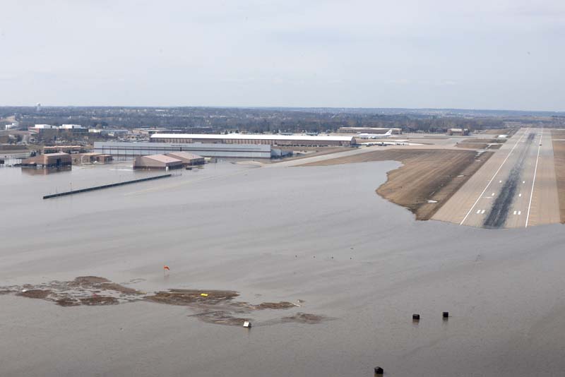
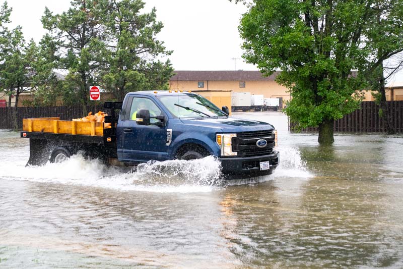
Locations along the coast often are the focus for flooding resilience investments, yet inland bases suffer similarly. For example, Offutt AFB in Nebraska experienced catastrophic flooding that submerged 3,000-ft of runway in March 2019. The inundation was the result of an intense rain-on-snow event, and it disrupted base operations for an extended period. Similarly, Scott AFB in Southwest Illinois has a history of both nuisance floods and flash floods, which have caused significant damage to hangars and other facilities. Scott AFB has documented at least six rainfall-attributed floods between 2000 and 2024. These incidents demonstrate how current airfield design standards (which only accommodate the 10-year flood event per Unified Facilities Criteria) and knowledge of previous flood-prone areas are not sufficient to protect military infrastructure.
In response, a recent effort, developed at the Air Force Institute of Technology (AFIT), has established a flood vulnerability index at the installation scale to score hazards based on potential threats to infrastructure systems.
Assessing Risk Levels
To provide more insight into pluvial flood hazards, researchers are developing broader definitions of risk and resilience metrics and applying them in different ways.
- Flood vulnerability indices are established as a function of exposure, susceptibility, and resilience to flooding from social, economic, environmental, and physical components.
- Flood vulnerability indices are foundational to other vulnerability assessment frameworks (hazards are scored based on potential threats to infrastructure systems).
- Historical applications of a flood vulnerability index are usually applied to larger areas, such as river basins.
Sustaining base operations is a primary focus of Air Force civil engineers—and flood vulnerability indices provide an intuitive way for decision-makers to assess flood hazards. While military installations are as susceptible to extreme precipitation as any campus setting, there remains a knowledge gap regarding the application of flood risk assessments. Researchers have seen success using flood vulnerability indices to accomplish study objectives, yet it remains difficult for airmen engineers to consistently apply risk metrics to infrastructure projects. A lack of functional resilience guidance within the military means installations often turn to outside organizations for help assessing flood vulnerability rather than relying on local expertise. Because of this, existing flood vulnerability frameworks largely do not account for defense-specific needs, such as asset condition or facility importance.
A common critique of flood vulnerability indices is that they are largely static. Urban hydrological systems consist of many complex processes that vary spatially and temporally; flood vulnerability indices often rely on characteristics that represent only a snapshot in time. Despite a general agreement that combinations of spatial and meteorological drivers provide more accurate results in assessing pluvial hazards, there is a lack of literature on how multiple rainfall characteristics affect flood vulnerability. For example, many researchers use only total rainfall depth or overall rainfall intensity, which can change throughout the duration of a storm. At the installation level, commanders require flexibility in decision-making; this, in turn, drives the need for dynamic, event-based flood vulnerability indices.
Adapting to Hazards
By addressing what spatial and meteorological data are most impactful for determining flood vulnerability, installations can adapt flood hazard assessments to their specific needs. There are three primary objectives that can improve understanding of flood risks.
- Parameterize the geographic and meteorological indicators that lead to flooding. Identifying which characteristics should be studied and quantifying them lays the foundation for generating flood vulnerability indices.
- Map and evaluate historical accounts of flooding. Studies on flood vulnerability indices often use historical flood extents for comparison purposes. Overlaying historical flood hotspots with flood vulnerability indices can identify repeat risks to missions and facilities as well as new areas of potential concern.
- Assess the dominant flood drivers. Knowing what characteristics are most influential allows researchers to adapt the flood vulnerability index to a particular installation and view hazards at the individual facility level.
Data on geographic parameters is readily available thanks to government organizations such as the U.S. Geological Survey and the Department of Agriculture. Obtaining comprehensive meteorological observations may prove more difficult, as nonconsecutive hourly readings require making assumptions for missing values. Installations must be intentional about compiling thorough records at all stages of flood tracking and management.
The capture of accurate and current data is essential to ensuring flood vulnerability maps are relevant and useful. Once the data is collected, installations then can utilize computer-based analysis tools with geographic and meteorological characteristics as inputs to the vulnerability index.
Identifying Investments
Using a case study at Scott AFB, the AFIT research team demonstrated a flood vulnerability index that evaluates both spatial and meteorological inputs. The project demonstrated that Air Force installations may already have the tools and expertise to generate flood vulnerability indices.
Often, civil engineering units have in-house knowledge of what physiographic characteristics drive flooding. At Scott AFB, impervious fraction, elevation, and drainage inlet condition emerged as the dominant vulnerability factors. By combining these inputs with GIS software analyses, researchers were able to produce more detailed and accurate vulnerability maps compared to historical flood extents than those created without consulting local engineers. The researchers also identified areas of concern for potential flooding that were not included in historical flood extents.
For meteorological characteristics, an importance analysis for historical storms at Scott AFB showed critical indicators that can trigger flooding, including antecedent moisture conditions in the soil. Weather forecasting can be operationalized within flood vulnerability maps to improve warning and notification. Some military installations have partially implemented this already by incorporating real-time flood sensors with soil moisture reading capabilities in certain areas around the base. Future sensors could be installed in expert-identified high-vulnerability locations. Forecasted storms with relevant meteorological parameters to that area (high antecedent rainfall, prolonged intensity) could then be identified to produce a dynamic, event-based vulnerability index. This approach presents an opportunity for targeted resource allocation—rather than blanket mitigation measures.
The capture of accurate and current data is essential to ensuring flood vulnerability maps are relevant and useful. Once the data is collected, installations then can utilize computer-based analysis tools with geographic and meteorological characteristics as inputs to the vulnerability index.
Prioritizing Mitigation
Flood risk modeling is challenging, multi-faceted, and dynamic amid changing environments. Experts with relevant experience and knowledge could be the key to creating better decision-making support systems. An understanding of flood hazards through vulnerability index maps can provide decision-makers with a visual representation of where to prioritize project funding.
By reducing impacts to missions and facilities, the tools proposed as part of AFIT’s research will ensure that installations can continue to project power in the face of extreme weather.
Capt. Andrea Rake, M.SAME, USAF, is Graduate Student, Air Force Institute of Technology; andrea.rake.1@us.af.mil.

Christopher Chini, Ph.D., is Research Scientist, Earth Systems Predictability and Resilience Group, Pacific Northwest National Laboratory; christopher.chini@pnnl.gov.
Published in the July-August 2026 issue of The Military Engineer

Check Out Related Articles From TME
-

Innovative PFAS Remediation at Camp Grayling
For project stakeholders and remediation managers confronted with PFAS, Regenesis demonstrates the efficacy of using Regenesis’ PlumeStop® colloidal activated carbon (CAC) at Camp Grayling, Michigan. -
A Standardized Approach to Aircraft Fire Training Infrastructure
To support enterprise-wide airmen readiness, the U.S. Air Force is modernizing its standard design for aircraft fire training facilities—introducing digital controls, dual-fuel systems, and PFAS-conscious infrastructure. -
Delivering Energetic Materials Manufacturing Facilities
Designing and constructing facilities that manufacture, process, handle, or store explosives and energetic materials present some of the most challenging defense projects—requiring technical experience, strict safety protocols, and a comprehensive understanding of regulatory frameworks. -
Forging Tradition and Innovation: A New Design Standard at Camp Lejeune
The II MEF Headquarters at Camp Lejeune blends Georgian Revival architecture with modern sustainability—delivering durability, efficiency, and precision that meets contemporary functional requirements while honoring heritage. -

Balancing Efficiency and Fiscal Responsibility
The continuing contracts clause offers the U.S. Army Corps of Engineers a way to improve project delivery and enhance fiscal responsibility by aligning funding with project execution. -
Next Steps for Digital Twin Development
U.S. Forces Japan is laying the groundwork for future integration of digital twin technology in order to validate and collect data that will offer comprehensive insights into utility conditions at installations and enhance overall decision-making, efficiency, and resilience.