Community Mission
The mission of the Geospatial Working Group (GWG) is to expand awareness and leverage the power of geospatial engineering to enhance operational outcomes. We aim to build a foundation that integrates people, processes, and tools, enabling the creation of digital solutions that improve engineering across basing, support, and battle spaces. Positioned under the Facility Asset Management (FAM) COI, the GWG serves as a vital cross-functional asset within SAME.
Join the SAME Engage GWG NetworkCOI Objectives
- Reinforce Geospatial Engineering as one of the three core doctrinal U.S. military engineer functions, emphasizing its role in supporting cross-functional missions across the entire Force.
- Support and contribute to Geospatial-Intelligence (GEOINT) activities by delivering engineering capabilities that enhance data accuracy and understanding of geographic locations.
- Provide expertise in data analysis and portrayal of both natural and constructed geographic features and boundaries, essential for mission planning and decision-making.
- Integrate diverse skill sets within Geospatial Engineering, including architects, cartographers, coders, data analysts, geospatial engineers, remote sensing specialists, and sUAS pilots, to offer comprehensive support to military and engineering operations.
- Leverage geospatial data to refine insights and enhance situational awareness for improved operational outcomes across multiple disciplines.
“The Geospatial Community of Practice is an umbrella
community encompassing Survey and Mapping, Remote Sensing, GIS,CAD-BIM, and
other groups engaged in geospatial work.“
– Mr. Jacob Watts, Geospatial Community of Practice Leader, USACE

Community Chair
Douglas Kaiser, PMP
Geospatial Project Manager
Organization Structure
Immediate Past Chair: Scott Ensign II, GISP, MSgt, Ret, USAF, Air Force Civil Engineer Center
Vice Chair, GeoWERX: Brian Best, GISP, HDR (Term ends May 2026)
Immediate Past Vice Chair, GeoWERX: Dan Mummert, PE, Pickett and Associates, LLC
(Term ends May 2026)
Assistant Vice Chair, GeoWERX (NEW POSITION– Vacant)
Vice Chair, Liaisons and Communications: Justus Eckstrom, Dewberry
Secretary (NEW POSITION– Vacant)
Senior Uniformed Advisor (NEW POSITION– Vacant)
Junior Uniformed Advisor (NEW POSITION- Vacant)
JETC 2025 (Louisville, KY)
- GeoWERX ’25 Demonstration
- Annual Geospatial Working Group Meeting
- DoD Installation Geospatial Information & Services Governance Group (IGG) Quarterly Meeting (IGG members only)
- DoD Geospatial Engineering Summit
- Geospatial Engineering Social
OPM Job Series
- Geography Series 0150
- Engineering Technical Series 0802
- Construction Analyst Series 0828
- Cartography Series 1370
- Cartographic Technician Series 1371
- Land Surveying Series 1373
- Geodetic Technician Series 1374
- General Physical Scientist Series – 1301
- Data Science Series – 1560
- Technical Information Specialist (Physical Science and Imagery) Series- 1412
Military (Uniformed)
Air Force
Army
USMC
U.S. Navy
DoD’s Digital Twin Definition: A digital twin is a virtual representation of a product, system, or process that uses the best available models, sensor information, data collected from the physical system, and input data to mirror and predict system activities and performance over the life of its corresponding physical twin and inform system design changes over time. There can be multiple digital twins of a system, but all digital twins should be based on authoritative sources of information and have clearly defined uses and scopes. Digital twins may vary in fidelity, based on the use case.
(Source: DoD Instruction 5000.97, Digital Engineering, December 2023/ Summary)
System of Systems: Built & Natural Infrastructure Digital Twin requires a system of systems approach as multiple sources of authoritative infrastructure data are derived via operations/ processes/ systems of distinct CE functional communities.

“The adoption of Digital Twins requires senior management to stop seeking short-term “solutions” and invest in a successful methodology capable of driving information management along the entire lifecycle. Because Digital Twins cannot be bought off the shelf, they require development by a robust methodology and strategic plan which focuses on the successful management of the flow of information across the entire construction lifecycle.” (Source: House of Digital Twins – AEC Business)
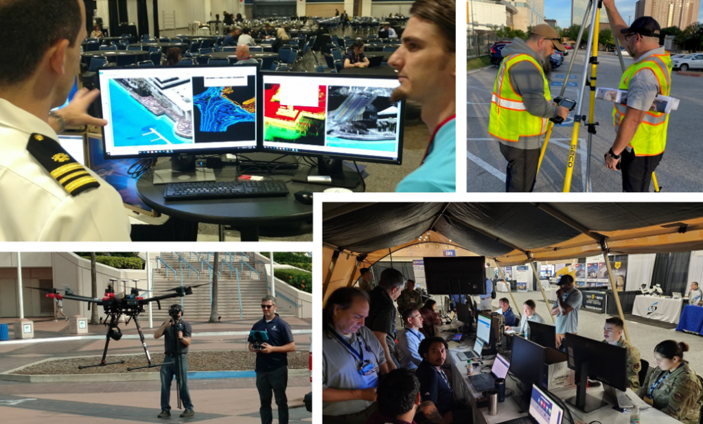
This annual demonstration executed during JETC offers a wide variety of expertise, processes, and tools for attendees to view in action, in addition the ability to discuss their application to unique mission requirements with those executing the demonstration.
Why GeoWERX? Pursuit of infrastructure Digital Twins has a very long history, but modern interests have been ignited by continued and sustained advances in technologies making them more accessible. The power of these types of capabilities are currently only limited by imagination and available resources; their potential return on investment- staggering. From traditional survey, BIM/ CAD, cartography, and GIS to Digital Twin, High-Definition Survey (HDS), sUAS, AI/ ML/ AR and beyond geospatial engineers continue to excel, showing the way!
GeoWERX ‘24 – JETC 2024, Orlando
- Story Map – pending
- Video
- Article- Guest Post: Engage With the “Silent Function” at JETC 2024
GeoWERX III – JETC 2023, San Antonio
GeoWERX II – JETC 2022, Aurora
GeoWERX I – JETC 2019, Tampa
- GISP – GIS Certification Institute (GISCI)
- GEOINT Professional Certification – National Geospatial-Intelligence Agency (NGA)
- Certified Survey Technician – National Society of Professional Surveyors
SAME has entered a partnership with Bootcamp GIS to offer our members the latest program of geospatial industry short courses. Engineers, planners, and environmental scientists can elevate their skills in the growing $18B Geographic Information System industry. As a Subject Matter Expert platform, our members can apply to author a course or sign up as a student to learn applied skills. You can take an individual course or earn a GIS certificate by taking six courses in six months.
Data
Data Standards
The key is to think about geospatial technology not as playing one particular role but as adding unique capabilities and progressively more value at different stages of the digital twin journey.
Upcoming National Webinars
-

- Webinar
Brave New World: Bid Protests in 2026 and Beyond
Any industry insider can tell you that bid protests have become – for good or for ill – an inevitable feature of many procurements. For that reason, successful contractors know how to both successfully assert a protest challenging a competitor’s improper award, and successfully defend against baseless protests brought by their own disgruntled competitors. -

- Webinar
Progressive Design Build: A New Delivery Method Now Available
Progressive Design Build – New NDAA language. This webinar will help explain the fundamental shift in federal construction delivery and clarify the meaning and application of qualifications-based selection processes for construction. Our expert presenters will address what this model means to acquisition teams and how industry evaluates and responds to these opportunities. -

- Webinar
Lessons Learned from Post-9/11 World Trade Center and Lower Manhattan Transportation Planning and Design
The events of 9/11 devastated critical Lower Manhattan transportation systems. In the early planning and rebuilding of the World Trade Center site, the Port Authority of New York and New Jersey’s in-house planning and architectural leadership established a master plan framework which considered its impact far into the future.


Related TME Articles – Geospatial Working Group
-

From Obligation Pressures to Mission Readiness: Rethinking Project Delivery in Defense Programs
Looking Forward presented by Procore. The next evolution in project delivery is the expansion from a system of record to a system of intelligence and collaboration where the value of centralized data is amplified through near real-time visibility and connected workflows. Leaders can move beyond static reporting and begin to understand what is happening across the portfolio as it unfolds. -
Leveraging SBIR/STTR in San Antonio, and Beyond
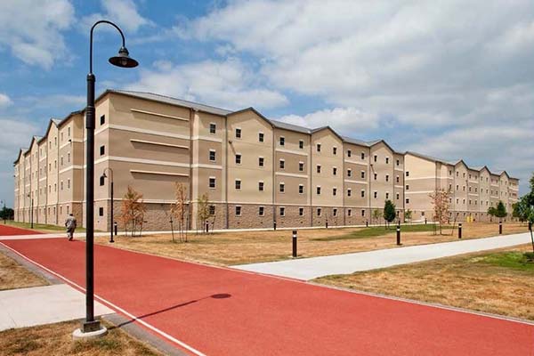
A dormitory maintenance solution created for Joint Base San Antonio demonstrates how projects developed through the unique federal funding mechanisms of Small Business Innovation Research and Small Business Technology Transfer can accelerate innovation across the military enterprise. -
Finding Common Ground: Military Planning Across Europe
A cross-country assessment of European military installations in support of U.S. Army Europe and Africa highlights how addressing gaps in master planning, cultural norms, and certifications can improve NATO’s ability to deliver interoperable infrastructure at increasing scale. -
Accelerating Mission Readiness Through Coastal Resiliency
Throughout the Pacific, coastal science and engineering are being applied to strengthen shoreline resilience, sustain critical infrastructure, and accelerate mission readiness.